New York John F. Kennedy International Airport (JFK)
Orientation and Maps
(New York, New York (NY), USA)
One of the world's most famous and exiting cities, New York is home to perhaps the most diverse collection of attractions in the world. Ranging from the vast and beautifully landscaped Central Park to some of the world's tallest and most iconic buildings, such as the Empire State Building and the Art Deco influenced Chrysler Building, New York really does have it all.
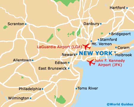
New York is home to three main airports, of which the John F. Kennedy Airport (JFK) is amongst the biggest and busiest in the world, being located on the southeastern side of downtown Manhattan. Within the city itself public transport is variable, comprising buses, subway trains and yellow taxi cabs.
New York John F. Kennedy Airport (JFK) Maps: Important City Districts
Long-haul buses in the city travel to and from the Port Authority Bus Terminal along 41st Street, with Greyhound buses traveling further afield and running services to Albany, Boston, Buffalo and Washington DC, amongst other cities. For those looking for a taste of the high-life, NYC limos are also available and provide a convenient and luxurious way to travel into the city.
Manhattan is home to many spectacular attractions, close to the Hudson River. This part of New York features a street-grid system that, outside of the main peak hours, surprisingly seldom become congested.
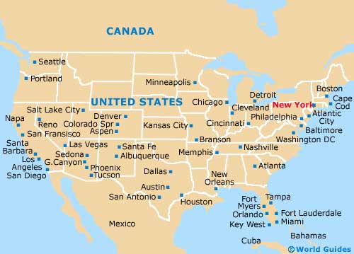
The are five main boroughs in the city, each with its own charm and appeal. Manhattan is the true heart of New York City and full of life. Other prominent districts include Staten Island, Brooklyn, Queens, and the Bronx. Many major interstates surround the city, which has become a major transport hub in this part of northeastern America.
USA Map
New York State Map
New York Map